


Almost every map app you open, every weather forecast you check and every headline about a shrinking glacier or a widening river shares a common ancestor: a fleet of satellites patiently photographing the surface of the Earth, orbit after orbit, decade after decade. The longest-running member of that family is called Landsat. If you have ever wondered what is Landsat, why it matters, and what those strange aerial ribbons of coastline and river actually represent, this is the plain-English guide, ending with how that same real imagery becomes something you can hang on a wall.
What Is Landsat?
Landsat is a joint satellite programme run by NASA and the United States Geological Survey (USGS), continuously imaging the Earth's land surface since 1972: the longest unbroken record of our planet gathered from space. NASA builds and launches the satellites; the USGS operates them and manages the archive of images they send back.
The single most important fact about the programme is this: the imagery is public domain and free. Anyone, from a climate scientist to a farmer to a curious member of the public, can download it. That open policy is a large part of why Landsat satellite imagery has steadily shaped modern life, underpinning mapping, agriculture, water management and disaster response all over the world.
Each Landsat satellite circles the Earth from pole to pole at roughly 700 kilometres, crossing the equator at the same local time on every pass. As the planet turns beneath it, the satellite builds complete coverage of the globe every couple of weeks: not a spy camera trained on one spot, but a methodical surveyor working the whole surface, again and again.
Landsat at a Glance
- Run jointly by NASA and the USGS
- Imaging the Earth continuously since 1972
- Orbits pole to pole at around 700 km altitude
- Covers the entire globe roughly every two weeks
- All imagery is public domain and free to download
How Landsat Sees the Earth
A Landsat satellite does not take photographs the way a phone does. It carries instruments that measure light in several separate bands at once, a technique called multispectral imaging: some visible to your eye (red, green, blue), others in wavelengths we cannot see, such as near-infrared. This matters because surfaces reflect light differently across those bands: vegetation glows brightly in near-infrared, while water absorbs it almost completely, which is why rivers, lakes and coastlines show up as crisp dark shapes against the land.
The current satellites resolve detail down to about 30 metres per pixel, coarse next to a drone shot but exactly the right scale for capturing the shape of a whole estuary or the sweep of a shoreline in one clean image.
What Satellite Imagery Actually Shows You
When people first look at raw satellite imagery of a coastline or river, it can be surprisingly hard to read: no label, no north arrow, no familiar street view, only the land as it genuinely is from above. Coastlines are among the most striking subjects, twisting into shapes no designer would draw on purpose. Rivers behave the same way: left to carve their own path over thousands of years, they loop, fork and double back, sometimes tracing forms that look almost deliberate.
The planet has been drawing shapes for millions of years. Satellites simply gave us the vantage point to finally read them.
Once you know what you are looking at, satellite imagery stops being abstract and starts telling stories: a headland shaped by centuries of current, a silver thread working its way to the sea, a patchwork of farmland shaped by the people who tend it.
Landsat, Sentinel-2 and a Continuous Record
Landsat is not alone up there. The European Space Agency runs a complementary programme called Sentinel-2, part of the wider Copernicus project, imaging the same land surfaces at a finer 10-metre resolution and revisiting each location more often. Its imagery is also free and open, and designed to work hand in hand with Landsat. Together the two give researchers a dense, decades-long, self-consistent record of how the Earth's surface is changing: a coastline retreating, a reservoir filling and emptying with the seasons, a city spreading across former fields.
For our purposes the point is simpler: between the two programmes, almost every coastline, river and landscape on Earth has been photographed clearly and repeatedly. Nothing is invented. The shapes are all real.
Make it personal
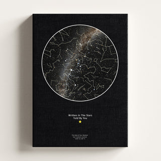
 Personalised Star Map | Custom Night Sky Print
From £21.99
View product →
Personalised Star Map | Custom Night Sky Print
From £21.99
View product →
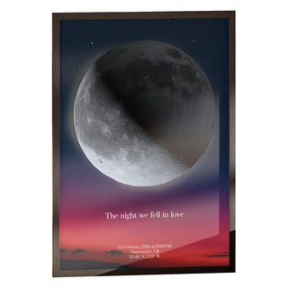
 Personalised Moon Map | by Skylit Studio
From £21.99
View product →
Personalised Moon Map | by Skylit Studio
From £21.99
View product →
 Personalised Moon Phase Map for Family | by Skylit Studio
From £21.99
View product →
Personalised Moon Phase Map for Family | by Skylit Studio
From £21.99
View product →
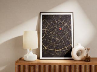
 Custom Location Map | Personalised Map Print by Skylit Studio
From £21.99
View product →
Custom Location Map | Personalised Map Print by Skylit Studio
From £21.99
View product →
 Your Name From Orbit
From £21.99
View product →
Your Name From Orbit
From £21.99
View product →
 Print Your Universe - Custom Image Print
From £19.79
View product →
Print Your Universe - Custom Image Print
From £19.79
View product →
What Is Landsat Imagery Used For?
Ask what is Landsat imagery used for and the honest answer is: an enormous range of things, most invisible to us in daily life.
Everyday Work Done With Landsat
- Tracking coastlines as they erode or build up over time
- Monitoring rivers, lakes and reservoirs for water supply
- Measuring crop health and mapping agricultural land use
- Watching glaciers and ice sheets advance and retreat
- Recording urban growth and changes in land cover
- Assessing floods, wildfires and other natural disasters
Because the record stretches back to 1972, Landsat is especially valuable for the long view: a single image shows what a place looks like today, while fifty years of images show how it got there. Farmers, hydrologists and emergency teams all rely on that record daily.
How to Read a Satellite Image
Reading a satellite image is a small, satisfying skill. Water is usually darkest, so the dark shapes are your seas, rivers and lakes. Vegetation reads as textured green, or vivid red in false-colour composites, while cities show as grey, angular patches with a geometry nature never quite matches. Natural boundaries meander and curve; human ones tend towards straight lines. Once your eye separates the two, a satellite image resolves into something you can actually navigate, even without a single label.
The same instinct that helps you trace a river on a map is what lets you recognise a familiar letter shape in a stretch of shoreline. That is exactly the leap that turns Landsat from a scientific tool into something personal.
From Data to Wall Art: Your Name From Orbit
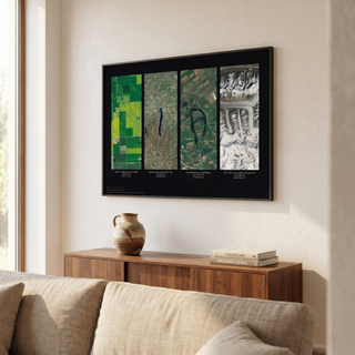
Here is where satellite imagery becomes a gift. Your Name From Orbit takes real Landsat and Sentinel-2 imagery and uses it to spell out a single chosen name in wall art, each letter formed by a genuine coastline, river or landscape feature shaped like that letter. Read more in our companion piece on your name in Landsat.
It is worth being precise about what this is, because it is easy to assume otherwise. Your Name From Orbit is a name gift, not a map of anyone's hometown. It spells one continuous word, a first name like LUNA or a surname like BENNETT, using letters only. The features that form those letters could sit anywhere on the planet: a bend in a Norwegian fjord for the L, a river delta in Asia for the U, an African headland for the N. The coordinates printed beneath each letter belong to that feature's own real location, not the recipient's address, so the artwork does not show a person their own neighbourhood from space. It does something arguably more surprising: it finds their name already written into the geography of the Earth, by rivers and coastlines that were carving those shapes long before any of us arrived.
A name you have said a thousand times, discovered hidden in the shape of the planet itself.
How Each Letter Is Formed
When you use the Your Name From Orbit designer at Skylit Studio, you type in a name and the customiser keeps only the letters A to Z, stripping out spaces, numbers and punctuation, so the piece is built letter by letter from a single word. Behind each character sits a real satellite view, a coastline, island, river or landscape whose natural outline reads unmistakably as that letter, with the true coordinates recorded alongside. The result is part typography, part atlas and part portrait of the Earth, and no two names produce the same set of places.
If you like the idea of turning a real moment or place into art, it sits naturally beside our other pieces. A personalised star map captures the night sky over a chosen date and location, previewable in our interactive night sky explorer or explained further in our guide to the night sky on a specific date. Where a star map looks up, Your Name From Orbit looks down.
Sizes, Frames and Finishes
Every Your Name From Orbit piece is a physical print, made to order and shipped from our facility in Manchester. It comes in five sizes, from A4 up to 60 x 80 cm, with prices starting at £21.99 for an unframed print and rising with size, framing and finish. Choose an unframed print, add one of our engineered wood premium frames in black, white or natural (dark brown is available on the A4 size), or opt for a gallery-wrapped canvas print that arrives ready to hang.
Unframed A4 prints ship flat in a rigid cardboard mailer, while unframed 30 x 40 cm prints and larger are rolled and posted in a sturdy tube. Framed pieces are wrapped and boxed, and canvas prints are boxed ready to hang with no frame needed. Order by 3PM on a working day, Monday to Friday, and we dispatch the same working day (canvas prints may need one extra working day to stretch and finish), so a last-minute gift is genuinely last-minute friendly. Add our gift wrapping service to include a personal message, typed by you at checkout and printed on a card tucked in with the order.
Frequently Asked Questions
What is Landsat in simple terms?
Landsat is a satellite programme run jointly by NASA and the United States Geological Survey that has photographed the Earth's land surface continuously since 1972, orbiting pole to pole and imaging the whole globe roughly every two weeks. All of its imagery is free to the public, making it the longest continuous record of our planet gathered from space.
What is Landsat imagery used for?
Landsat imagery is used to track coastlines, monitor rivers and reservoirs, measure crop health, watch glaciers and ice, record urban growth and assess floods and wildfires. Because the archive stretches back over fifty years, it is especially useful for studying how places change over time.
How is Landsat different from Sentinel-2?
Landsat is the NASA and USGS programme running since 1972; Sentinel-2 is a European Space Agency programme imaging the same land surfaces at a finer 10-metre resolution. The two are designed to complement each other, and both are free and open. Your Name From Orbit draws on real imagery from both.
Does Your Name From Orbit show the recipient's own town from space?
Your Name From Orbit spells a chosen name using real coastlines, rivers and landscapes found anywhere on Earth that happen to form each letter. It is not a map of the recipient's own town: the coordinates printed with each letter belong to that geographic feature, not to the person. That is what makes it a surprise, a familiar name discovered already written into the shape of the Earth.
Can the name include spaces or more than one word?
The designer keeps only the letters A to Z, so it works with a single continuous word such as a first name or a surname. Spaces, numbers and punctuation are removed automatically. Choose one name that means something to the recipient, and each letter will be formed from a real satellite view of the Earth.
Is the imagery genuinely real?
Yes. Every letter is built from real Landsat and Sentinel-2 satellite imagery, drawn from the same public-domain archives that scientists use. Nothing is illustrated or invented.
How quickly can I receive one?
Every print is made to order at our Manchester facility. Order by 3PM Monday to Friday and we dispatch the same working day (canvas prints may need one extra day to stretch and finish), with tracked UK delivery and next working day options at checkout.
The Earth, Already Holding Your Name
Landsat began as a scientific instrument, a way to measure crops, water and ice from orbit, and it still does that work every single day. But the same honest imagery that maps a changing coastline can also be read the way we read clouds: for the shapes hiding inside it. Your Name From Orbit follows that instinct to its conclusion, finding a chosen name spelled out in rivers and shorelines that have been drawing letters for millennia. The planet has been writing all along; now you can put a little of that writing on a wall.


