


Most star charts online are pictures. A flat diagram of the constellations, fixed to one season, drawn as though the sky sits still. It does not. What stands above your garden tonight is not what stood there in March, and it is nothing like what stands over Sydney at this exact second.
So we built the alternative and left it open to everyone. The Night Sky Explorer is a real planetarium that runs in a browser tab: the true sky for any date, any time, and any place on Earth, with about 41,000 stars, the planets on their real orbits, the Milky Way, deep-sky objects and satellites passing overhead while you watch. It is free to use, there is nothing to install, and you do not need an account.
This is a walk through what it actually does, and how to get the most out of it.
What the Night Sky Explorer Is
It is an interactive star chart in the proper sense of the phrase. Not an illustration of the sky, but a calculation of it. Give it a place and a moment and the engine works out where every object genuinely was, then draws that view from the ground, complete with a horizon in the right direction and a sky that brightens or darkens according to where the Sun sits.
Drag to spin the view. Pinch or scroll to zoom. Tap anything and a card opens telling you what it is, how high above the horizon it stands, which way to look for it, and, for stars, how far away it is in light years and what colour and size that makes it. Nine layer buttons sit along the bottom, so you can switch constellation lines, labels, the mythological figures, a coordinate grid, planets, deep sky, the landscape silhouette, satellites and the atmosphere on or off until the view shows only what you want.
A star chart tells you what the sky looks like. An interactive star chart lets you ask it a question.
Skylit StudioWhat You Can See In It
The star field carries roughly 41,000 stars, which is far more than any eye has ever picked out from a British garden. Zoom in and fainter ones appear as the view can hold them; zoom out and the chart thins itself back to the bright framework of the constellations so the shapes stay readable.
What the Explorer Draws
- Stars: about 41,000, with real distances in light years for the naked-eye population
- Constellations: the 88 official boundaries, with lines, names and the classical figures as optional layers
- Planets: Mercury through Neptune, plus the Sun and Moon, from full ephemeris positions
- The Milky Way: rendered as a band across the sky rather than a painted-on texture
- Deep sky: the Messier catalogue and selected NGC objects, tappable for details
- Satellites: live orbital elements, so the International Space Station and its neighbours cross in real time
- Sky and ground: a physically modelled atmosphere for daylight, dusk and darkness, over a landscape horizon
The satellite layer is the one that surprises people. Switch it on during a clear evening and you can watch the ISS track across in the same minutes it is genuinely passing over you, which turns an abstract chart into something you can walk outside and verify. Our guide to the night sky tonight in the UK with no equipment pairs well with that, because almost everything in it can be found on the chart first and then in the air.
How to Use It in Three Steps
1. Set the place
There is a Place field at the top. Type a city, a town or a village, choose it from the list, and the whole sky rotates to the horizon of those coordinates. This matters more than people expect. Move from Manchester to Cape Town and the familiar constellations flip over and slide off the bottom of the view, replaced by stars most of us have never seen.
2. Set the date and time
Next to it sit a date field and a time field. Type them, or use the arrows on the time-travel panel to nudge the year, month, day, hour or minute one step at a time and watch the sky respond as you go. There is a Now button whenever you want to snap back to the present, and a play control that runs the clock forward so the stars wheel westward the way they really do.
3. Tap things and read
Once the view is set, the chart becomes something to interrogate. Tap a bright point and find out whether it is Vega or Jupiter. Tap a smudge and learn it is the Andromeda Galaxy. There is a search button too, so if you already know the name of what you are after, you can jump straight to it and the view will centre on it.
If you want to know which shapes you are actually looking at, our guide to the constellations in the UK sky works through finding all 88 of them season by season.
Make it personal
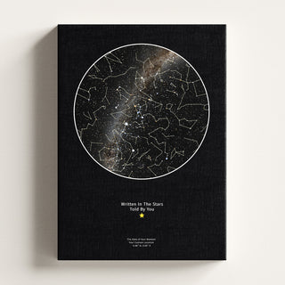
 Personalised Star Map | Custom Night Sky Print
From £21.99
View product →
Personalised Star Map | Custom Night Sky Print
From £21.99
View product →
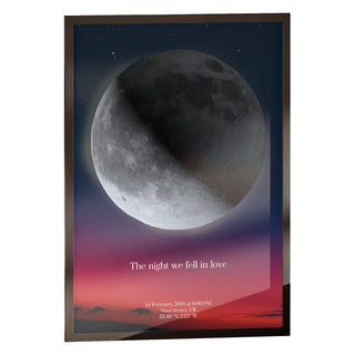
 Personalised Moon Map | by Skylit Studio
From £21.99
View product →
Personalised Moon Map | by Skylit Studio
From £21.99
View product →
 Personalised Moon Phase Map for Family | by Skylit Studio
From £21.99
View product →
Personalised Moon Phase Map for Family | by Skylit Studio
From £21.99
View product →
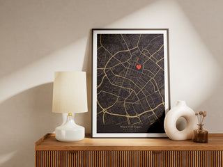
 Custom Location Map | Personalised Map Print by Skylit Studio
From £21.99
View product →
Custom Location Map | Personalised Map Print by Skylit Studio
From £21.99
View product →
 Your Name From Orbit
From £21.99
View product →
Your Name From Orbit
From £21.99
View product →
 Print Your Universe - Custom Image Print
From £19.79
View product →
Print Your Universe - Custom Image Print
From £19.79
View product →
Travelling Through Time
This is where a free star map online stops being a novelty and starts being useful. The engine will compute a sky for any date between roughly 3000 BCE and 3000 CE, which is five thousand years in either direction.
Point it at your own birthday and see what was overhead. Point it at the night you met someone, at a wedding, at a first Christmas. Wind it forward and watch the constellations themselves slowly deform as the stars drift apart over the centuries, because they are not a fixed pattern, only a fixed pattern for now.
It works just as well for planning. Set it to next Tuesday at ten in the evening and you will know before you go outside whether Saturn has risen, where the Moon will be sitting, and whether the Milky Way is anywhere useful. We have written separately about what the sky looked like on a specific date, and the Explorer is the fastest way to answer that question for yourself.
Five Things Worth Looking Up
- The sky over the hospital on the morning someone was born
- A total eclipse from centuries ago, seen from the town it crossed
- Tonight, from a dark-sky site you are thinking of driving to
- The same date one hundred years from now, from your own street
- Midsummer midnight from somewhere inside the Arctic Circle, where it never gets dark
Leaving the Horizon Behind
Three buttons at the foot of the screen read Earth, Solar System and Galaxy, and they change what you are standing on.
Solar System lifts you off the ground into a view of the planets running their real orbits around the Sun, with the same clock driving them. Scrub the date and the whole system turns. The planets are textured with real mission photography from NASA and ESA rather than artistic impressions, so Jupiter's bands and Mars's surface are the genuine article, and you can open any of them full screen to spin the globe.
Galaxy keeps pulling outward. Past the Kuiper Belt, past the Oort Cloud, out into a field of about 15,000 real stars placed at their true measured distances, where the constellations you know come apart into a three-dimensional scatter because they were never really shapes at all, only a line of sight. Beyond around 3,200 light years the measured data runs out and the view hands over to a modelled Milky Way, with the Sun marked about 26,000 light years from the centre. That spiral is a model, not a photograph. Nobody has ever seen our galaxy from outside it, and the Explorer says so on screen rather than pretending otherwise.
Zooming back in reverses the journey and drops you home on your own horizon, at the same moment you left.
Holding It Up to the Real Sky
On a phone there is an AR button. Grant it the camera and the chart lays itself over the live view, so you hold the handset up at the sky and the labels sit on the actual stars in front of you. Sweep it along the horizon to find Orion, or point it at the ground to see what is currently on the other side of the planet.
Star density is dialled back in AR to about 1,600 of the brightest stars, which is roughly what a clear night gives an unaided eye. That is deliberate. A screen crowded with 41,000 dots is impossible to match against the real thing, and matching against the real thing is the entire point.
The Smaller Touches
A few things exist because we use this ourselves and got tired of doing without them.
There is a night vision toggle that washes the interface red, so a phone in your hand outdoors does not undo twenty minutes of dark adaptation. There is a full-screen control, and a hide-controls control that strips every button away and leaves nothing but sky. On a laptop, that makes a decent thing to leave running on a second screen.
There is also a free embed builder. Choose a location, a date, the layers and a size, copy the generated snippet, and you can drop a working sky into your own website: a school page, a wedding site, an astronomy society's write-up. It runs on any domain. All we ask is that the small Skylit Studio credit stays on it.
How Accurate Is It?
The engine is built on the d3-celestial library with Yale Bright Star Catalogue data and full planetary ephemeris, giving positions accurate to the arc-minute across that five-thousand-year window. Distances come from the HYG catalogue, which is derived from the Hipparcos mission's parallax measurements, and cover essentially every star bright enough to see unaided.
The same calculation engine sits behind our printed work, which is the reason the Explorer exists in the first place: it began as an internal tool for checking that our maps were right. Our page on the astronomical precision behind our star maps goes into the method properly, including how positions are corrected for precession and how the horizon is derived from your coordinates.
Two honest caveats. The modelled spiral arms in Galaxy view are an interpretation, as noted above. And satellite tracks depend on orbital data that is refreshed regularly but is a prediction rather than a live radar feed, so a pass may run a few seconds off.
Turning a Moment Into Something You Keep
Most people who open the Explorer end up doing the same thing within about a minute. They stop browsing and type in a date that means something.

The chart will show you that sky for as long as you leave the tab open. If you want it on a wall instead, that is what a personalised star map does. You give us the date, the time and the place, we run the same calculation, and it comes back as a printed chart with your own wording set beneath it, framed and posted from our studio in Manchester.
Nothing about the Explorer is a trial version of that, and you never need to buy anything to keep using it. It is simply that a browser tab closes and a framed print does not. What makes the print personal is not the astronomy, which belongs to everyone who was outside that night, but the pairing of the moment you chose with the words you put under it. Written In The Stars. Told By You.
If the Moon is what you remember from the night rather than the stars, a personalised moon phase print takes the same date and renders its exact phase instead. Our how it works page walks through the ordering process, and for a broader look at the options there is our complete star map buyer's guide.
Sizes and Prices
Every print comes in five sizes: A4, 30x40 cm, 40x50 cm, 50x70 cm and 60x80 cm. Unframed prints start at £21.99 and run to £69.99 for the largest. Framed versions, in engineered wood in black, white or natural oak, run from £36.98 to £119.98, with dark brown available in A4. Gallery-wrapped canvas comes in four sizes, A4 up to 50x70 cm, starting at £49.99.

Order by 3PM on a working day and your print is dispatched the same day, with free tracked UK delivery. Unframed A4 ships flat in a rigid cardboard mailer, larger unframed sizes are rolled into a sturdy tube, framed prints are wrapped and boxed, and canvases arrive ready to hang.
Frequently Asked Questions
Is the Night Sky Explorer really free?
Yes. It runs in any modern browser at skylitstudio.co.uk/night-sky with no account, no download and no trial period. Every feature described here, including AR mode, the Solar System and Galaxy views and the embed builder, is open to anyone who visits the page.
How far back and forward can the interactive star chart go?
Roughly 3000 BCE to 3000 CE. Within that window the engine calculates real positions rather than approximating them, so an ancient eclipse and a sky a few centuries from now are both computed the same way as tonight.
Can I see the sky from a specific city or town?
Yes. Type any city, town or village into the Place field and the view rotates to the horizon for those coordinates, showing the stars, planets and constellations that stood above that spot at the moment you have set. Changing hemisphere turns the sky over completely.
Does it work on a phone?
Yes, and the phone version adds AR. Point the camera at the sky and the labels overlay the stars you are looking at, which is the quickest way to learn a constellation. On a phone it is worth switching the night vision filter on before you go outside.
Can I put the interactive night sky map on my own website?
Yes. The embed builder on the page generates a snippet with your chosen location, date, layers and dimensions, and it works on any domain at no cost. The only condition is that the small Skylit Studio credit stays visible.
Is this the same sky used for your printed star maps?
The same calculation engine, yes. The print is styled for the wall rather than the screen, with your chosen typography, message and frame, but the star positions come from the identical astronomical method, which you can read about on our precision page.
Do I need to buy anything to keep using it?
No. The Explorer is a tool we maintain because we enjoy it and because it is the honest way to show what our prints are built on. Use it for as long as you like without ordering a thing.
Go and Look
The best thing about an online star map that computes rather than illustrates is that it will answer questions nobody wrote it for. What was above the trenches on Armistice night. Whether Venus really was that bright last Tuesday or whether it was a plane. What your grandmother would have seen walking home from her wedding.

Open the interactive night sky map, put in a date that matters to you, and see. If what comes back is worth more than a browser tab, we can print it.


