


It is the question almost everybody asks quietly before spending anything: is the sky on a personalised star map the real sky, or a pretty pattern with a date typed underneath? Fair question, and the two look identical in a product photo. This guide sets out what determines whether a star map is astronomically accurate, what our prints are calculated from, what they simplify on purpose, and how to verify the whole thing yourself in two minutes without buying anything.
The Short Answer
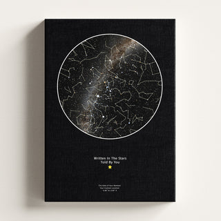
A personalised star map from Skylit Studio is a genuine astronomical chart. Every star is plotted at its true position for the date, time and coordinates you enter, sized by its real apparent brightness and tinted to its actual spectral colour. If a planet was above your horizon that night, it appears. Constellation outlines follow the official boundaries set by the International Astronomical Union. Change the time by three hours and the chart rotates, exactly as the real sky does.
So accuracy is not a property of the poster. It belongs to the calculation behind it, and to the three details you type in, which are also the only part that can go wrong.
Date, Time and Place: The Three Inputs
The night sky is not one fixed picture. It depends on where the Earth sits in its orbit, how far it has spun since noon, and which patch of the globe you stand on. Those are the three fields in the customiser.
The date sets which half of the sky is on show
As the Earth travels around the Sun, the stars behind the Sun are lost in daylight and the stars opposite it own the night. That is why Orion is a winter sight from the UK and Scorpius barely clears the southern rooftops in summer. Move your date by six months and you get an almost entirely different cast of constellations.
The time rotates the whole chart
The Earth turns roughly fifteen degrees an hour, so the sky wheels overhead through the night. A chart for 9pm and one for 2am hold the same stars in noticeably different places, with some risen and others already set. This is the input people most often get slightly wrong, usually by rounding a moment they actually remember precisely. Daylight saving matters too, since the calculation converts your local clock time to universal time before working out where anything was. We walk through the whole method on our page about the astronomical precision behind our star maps.
The place decides your horizon
Latitude is the big one. From Manchester at roughly 53 degrees north, the Plough never sets and the Southern Cross never rises. Keep the date and time but move to Sydney and the chart is unrecognisable. In practice a town twenty miles away gives a chart you could not tell apart, while a different country gives a different sky. Our guide to the night sky on a specific date and location goes further into how much a change of place really moves things.
Where the Stars Themselves Come From
Positions are only as good as the catalogue behind them. Ours come from the sources professional astronomy uses: the Hipparcos and Tycho-2 catalogues compiled by the European Space Agency, refined with the latest public Gaia release, which sharpens both coordinates and proper motions. Deep-sky objects are referenced against Saguaro Astronomy Club data.

Two things follow. Dot sizes mean something: a star is drawn at the size its apparent magnitude warrants, down to magnitude 6, the faintest a healthy eye catches under dark skies. Colours mean something too, since each star is tinted to its spectral class, so hot O and B stars come out blue-white and cooler K types orange. That is why a Skylit Studio chart reads mostly white, blue and gold: red dwarfs are the commonest stars in the galaxy, and almost all are far too faint for the naked eye to reach.
Planets get the same treatment. When one was genuinely above your horizon it is rendered as a real photographic disc built from spacecraft and telescope imagery rather than a generic marker, so Mars arrives rusty and Saturn banded. If none was up that night, none is invented to fill the space.
Constellation Lines and IAU Boundaries
Constellations are the part of a chart most open to artistic licence, which makes them a useful test. The International Astronomical Union divides the sky into 88 constellations with formally defined borders, and every point of sky belongs to exactly one. Our outlines follow those boundaries, so the figures sit where an astronomer expects them rather than where a designer found them prettiest.
It is also where the confusion about star maps and star signs starts. A birth sign is an astrological label tied to the Sun's position, and the Sun is not on a night chart, so a Leo does not get Leo blazing in the middle. We untangle that in our explainer on what IAU constellations are and how they differ from zodiac signs.
Accuracy is not something you can see in a product photo. It is something you can check, and a real chart will survive the checking.
Skylit StudioMake it personal
 Personalised Star Map | Custom Night Sky Print
From £21.99
View product →
Personalised Star Map | Custom Night Sky Print
From £21.99
View product →
 Personalised Moon Map | by Skylit Studio
From £21.99
View product →
Personalised Moon Map | by Skylit Studio
From £21.99
View product →
 Personalised Moon Phase Map for Family | by Skylit Studio
From £21.99
View product →
Personalised Moon Phase Map for Family | by Skylit Studio
From £21.99
View product →
 Custom Location Map | Personalised Map Print by Skylit Studio
From £21.99
View product →
Custom Location Map | Personalised Map Print by Skylit Studio
From £21.99
View product →
 Your Name From Orbit
From £21.99
View product →
Your Name From Orbit
From £21.99
View product →
 Print Your Universe - Custom Image Print
From £19.79
View product →
Print Your Universe - Custom Image Print
From £19.79
View product →
What a Print Simplifies on Purpose
Honesty cuts both ways, so here is what a printed chart does not attempt.
- It stops at magnitude 6. The catalogues hold millions of stars. A print holds the ones an eye could actually have seen, because a chart plotted far fainter would render as grey fog at arm's length.
- It is a flat projection of a curved sky. Any circular chart squashes a dome onto a disc, so shapes near the edge stretch slightly.
- Constellation lines are a convention. The boundaries are official; the joining lines between stars are a long-standing drawing habit that helps the eye find the shape.
- Atmosphere and light pollution are not simulated. The chart shows the sky that was geometrically over you, not the sky as filtered through cloud, streetlight or a bright moon.
- Style choices affect the look, not the positions. Themes and colourways change the background treatment; the stars stay where the maths puts them. Our buyer's guide to personalising a custom star map covers those options.
How to Check the Sky Yourself
You do not have to take this on trust, and we would rather you did not. Our free interactive Night Sky Explorer is a live planetarium running the same kind of calculation, with around 41,000 stars, the planets, the Milky Way, deep-sky objects and live satellites. Set it to your date, time and place, then compare.

Three checks worth running:
- Test it against a night you remember. Pick an evening you were outside and could name something overhead, then set the Explorer to that moment and see whether it agrees.
- Move the clock. Wind the time forward a few hours and watch the sky rotate. A decorative graphic would not budge.
- Move the place. Keep the date and time, then jump to the other hemisphere. The constellations should change wholesale, not shuffle.
Set it to the exact moment you want on the print and you have previewed the chart before spending anything. There is more in our write-up of the free interactive star chart, and if you would rather just look up, our guide to what you can see tonight in the UK with no equipment pairs well with it.
Calculated Sky vs Decorative Sky
What you are buying from Skylit Studio is a calculation: real catalogue positions, real magnitudes, real spectral colours and official boundaries, resolved for one chosen moment. Two other things get shopped alongside it, and both deserve judging on their own terms.

Star naming registries let you dedicate a named star to someone, which as a sentimental gesture is a lovely idea and warmly received by plenty of people. On the narrow question of astronomy, only the International Astronomical Union assigns official star names, so a registry certificate is a keepsake rather than a catalogue entry. A different kind of gift, not a worse one, and some people happily buy both. Template art is the other: a beautifully designed star field, the same artwork for every buyer, with a date set underneath. It can look wonderful on a wall. It is simply not computed from anything, so it will not survive the checks above.
What makes a print yours is the moment you singled out and the words beneath it, and that is the part no calculation supplies. Written In The Stars. Told By You.
The Moon Print Works the Same Way
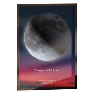
The same engine sits behind a personalised moon phase print. Phase is a matter of geometry between Sun, Earth and Moon, so the illuminated fraction on your chosen date is calculated, not picked from a set of eight stock crescents.
Location matters here too. The Moon's orientation depends on where you view it from, so a crescent leaning one way over Edinburgh leans differently over Auckland, and libration, the slight rocking that lets us see a little around the lunar limb, shifts what faces Earth on a given date. Our complete buyer's guide to personalised moon phase prints covers the options. For several dates together, a birth, a wedding, a move, the family moon phase print places one calculated moon per date along a row.
Before You Order
Get the three inputs right and the rest takes care of itself: the real local time rather than a tidy round number, the town you were actually in rather than the nearest city, and a look at the moment in the Explorer first. The how it works page covers the rest. After that the only decisions left are about the wall, and the chart itself will be the sky that was there.
Frequently Asked Questions
Are star maps actually accurate?
A properly calculated one is. Skylit Studio charts plot every star at its true position for the date, time and coordinates you enter, using Hipparcos, Tycho-2 and Gaia catalogue data, with dot sizes set by real apparent brightness and colours by spectral class. Decorative celestial art that repeats one star field for every customer is a different product, and the difference shows the moment you compare it against a live planetarium.
How is a star map calculated?
Your local date and time are converted to universal time, fixing the Earth's rotation and orbital position for that instant. Your coordinates fix the horizon and which half of the sky sat above it. Catalogue star positions are then projected onto a flat disc, planets added if they were genuinely up, and constellation outlines drawn to official International Astronomical Union boundaries.
Does the exact time really change the picture?
Yes. The sky rotates about fifteen degrees an hour, so a chart for 9pm and one for 2am on the same night look clearly different, with some constellations risen and others set. Daylight saving is handled in the conversion, so enter the local clock time as you remember it.
How can I check what the night sky looked like on a specific date?
Open our free Night Sky Explorer, set the date, time and place, and look. It is a live planetarium with around 41,000 stars plus planets, the Milky Way and deep-sky objects, and it travels to any moment in time. It costs nothing, and it is the simplest way to confirm a sky before ordering a print of it.
What sizes and prices are available?
Star maps come in A4, 30 x 40 cm, 40 x 50 cm, 50 x 70 cm and 60 x 80 cm. Unframed prints run from £21.99 at A4 to £69.99 at 60 x 80 cm, framed from £36.98 to £119.98, and canvas from £49.99 up to £99.99 at 50 x 70 cm, which is the largest canvas. Frames come in black, white and natural, with dark brown also available at A4.


